Saturday, July 29, 2006

Twenty Miles and Two Girls

Best Friend and I just completed the longest 20 miles in the world. Victorious, elated, proud, and relieved are few adjectives that describe how I am feeling right now. I had read much about how the 20 mile Paintbrush Divide loop trail in Grand Teton National Park was one of the most scenic and challenging day hikes anywhere in country. I wanted to see it, to be there and then taste the sweetness of success. Many people backpack in and camp and do not do the entire 20 miles in one day. But some people do. And Best Friend and I are two of them.

The loop began at String Lake then ascended up Paintbrush Canyon past Holly Lake and finally up to the Paintbrush Divide at 10,700 ft. The trail descends in steep switchbacks down the side of the mountain into Cascade Canyon passing Lake Solitude. It continues down lower into the canyon until it meets a fork and follows along the Cascade Canyon Trail until finally you can fork off to the side trail that leads back to String Lake. I knew it was long and challenging trail, but had been looking forward to this challenge and experiencing its beauty all summer long. After all the researching and planning, I suddenly found myself standing at the first trail head at String Lake at 6:15 a.m. ready to accomplish this goal. Eleven hours and forty five minutes later, it was done.

Now I tale the story of those torturous 11 hours and 45 minutes...

The trail began to gently ascend and despite the fact that neither of us had a decent night’s sleep, I was feeling pretty good. It seemed that we knocked the first of the miles out fairly quickly. We knew we were in bear country here so we continuously sang aloud and talked and occasionally let out a hoot or holler because that is what you do while hiking in bear wilderness to warn bears of your presence and prevent any dangerous altercations that might occur if you happen to stumble upon one and surprise it. I have said before that I am not afraid of bears and will not avoid hiking and camping in areas just because they are present. Still, I have to admit that I had an uneasy feeling about an encounter because of reports of aggressive bears in the area lately. (I think it has to do with the extreme heat and dry that the area has been dealing with this summer. Weather affects food resources and that will affect animal behavior)

. Despite the uneasy feeling, we began the trail and were well on our way to Holly Lake, the first major site on the journey. We were discussing our latest money-making scheme and laughing when suddenly we were interrupted by a black bear cub darting quickly ahead of us on the trail. I saw it before Best Friend and mouthed some sort of warning to her and we began to back away slowly. But before we even had time to locate mother bear, she suddenly charged us! It was a bluff, but she did not back away from us. As she stared us down, palpable fear spread through my veins; but reminding myself that survivors are the ones that do not panic, I kept my cool. Both Best Friend and I remained calm and followed the “aggressive bear encounter rules”. We slowly backed away, giving her space but standing tall and yelling to her. She then backed further into the woods and continued her foraging. The problem was that the cubs had climbed into a tree right next to the trail. Any time we attempted to proceed along the trail, mother bear would move in closer to us. We would retreat back down the trail. Then she began to follow us whichever way went! I absolutely didn’t know what to do. Just when I thought it couldn’t get any worse, the bear moved in close to the trail and began to claw a downed tree leaning against another tree. She tore at the bark viciously and tore away with her teeth. Perhaps she was simply snacking on insects within the tree, but I couldn’t help but feel it was threat to us. I couldn’t help but think of those claws and myself in the tree’s position. This is going to hurt. I began to pray. Best Friend and I wished desperately that someone else would show up on this trail. Just like an answered prayer from God, three very nice men walked up behind us. They were the first people we met since we began. The safety in numbers theory proved true as the men joined us and the five of us humans together were intimidating enough to mother bear to allow us to finally pass.

Adrenaline was running high through my blood for a while as we continued on our trek. Before reaching Holly Lake, we saw a bull moose with a large rack chomping on some brush. We were averaging about 2 miles per hour on our climb until we reached Holly Lake. It took us two hours to trek the 2.2 miles up to the top of the divide from the lake. It was an incredibly steep climb at this point and altitude sickness began to kick in for the both of us. The nausea and vertigo I experienced were mild but the breathlessness was terrible. At times I hiked only a few yards before gasping for air. Finally the top of the divide was in sight. We crossed several snow fields. It did not bother me to slip and slide along the slick snow until I began to cross one that was long and slanted at an angle. If you were to slip, you’d have fallen down a steep slope and if the banging of your head multiple times and the breaking of your bones as you tumble helplessly down to the bottom didn’t kill you, certainly the freezing cold lake full of floating ice would. My right side was on the exposed side so I tried not to look anywhere except down at my feet that I was carefully trying to place in the footsteps left by other hikers as they crossed the snow. I slipped and I again I felt that panic-induced adrenaline. I dug my left hand into the snowbank for support. After what seemed like a mile, I had made it across. Though I did not know it yet, it was only the beginning of unstable material that I would depend on as I stood on exposed ledges.

My heart sank as I saw the trail wind up through loose scree (rocks) with nothing to grasp for support except for the few solid rocks holding the loose ones in place. I managed to handle it fairly well, though very nervous, until we reached a part where the trail sort of split up and you had to choose your own way. We chose the wrong way. I found myself stuck and then sliding down with loose rock. I was able to catch a stable rock with my foot and then reach out to it. I was stuck and I knew it. I reminded myself again of how to stay calm and be a survivor. Best Friend was on a rocky ledge above me and was able to see that there was a more stable and easier trail that was only a few steps away from me. She scrambled down onto the tail and walked back down to where I was so that I could see which way to go. I allowed myself to slide down to where she stood and scrambled along the “real” trail. It was so much easier, though I was still quite nervous. Finally after reaching the top of the divide at 10,700 ft., I cried tears of joy. Sure I was only half way finished, but I had survived an angry bear, a slanting slope of snow, and loose rocks daring to throw me down to the mountain’s foot and best of all, it was all downhill from here!

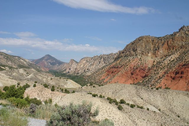
It was a steep downhill from the divide to Lake Solitude. I know what goes up must come down, but I couldn’t believe just how far we had gone up until I followed the steep switchbacks and it seemed the valley floor wasn’t getting any nearer! Resting and snacking by Lake Solitude (elevation, 9,035 ft) was a sweet treat. We did not rest for long as we felt invigorated for having made the divide and we ready to hike the rest of Cascade Canyon. We had hiked Cascade (in reverse) up to the forks two years ago so we knew what a scenic treat we were in for. We had only 2.7 miles to reach the forks.

We covered those 2.7 miles quickly and happily. It was very pretty, though we were still in the open sun and I was looking forward to reaching the forks, as I knew it was shadier there. When at last we did reach the forks, I saw the trail sign informing us that we had a mere 6.2 miles left until we were done.

Cascade Canyon was as beautiful as ever, but it somehow seemed longer than ever, too. About halfway through those 6 miles, my body was really beginning to feel the exhaustion and hell that I had put it through. My several-times-twisted ankle was sore as well as the ligament behind my right knee. My thigh and butt muscles were tight. Still, knowing that the parking area was growing closer with each step we trudged on. Along the trail we spotted marmots and pikas and even a cow moose. It was a beautiful walk but I was ready for it to be over. Exhaustion began to rule me. I was done.

The trail that lead back to String Lake finally came into view on the left. That 1.7 miles was pure misery and the longest 1.7 miles I ever walked in my entire life. Even considering my slowed stride, it should not have seemed this long. Every bend should have been the end in my mind. It never was. I was developing a bad attitude. My body was collapsing. I didn’t want to see another cascading stream, moose, flower, and certainly not another bear. All I wanted to see was the car. And I wanted a Frosty from Wendy’s.

I came around another bend and saw a sign. I knew that if I read it and it said that String Lake was still a mile away, I would have screamed. To my relief it informed me that I had .3 mile left. Soon I saw the bridge crossing the water and leading to the parking area. Then I saw the car as I crossed the bridge. I wanted to again cry tears of joy, but I was too tired.

I was so proud of myself for making it. I was so elated to know that I could sit down and rest. I was so relieved that my body wouldn’t have to endure another painful step. Sweet victory! I couldn’t get to Wendy’s fast enough.

That Frosty was the best I ever had as were the chicken nuggets, fries, and biggie sized diet coke that I scarfed down. Sweet, delicious victory!

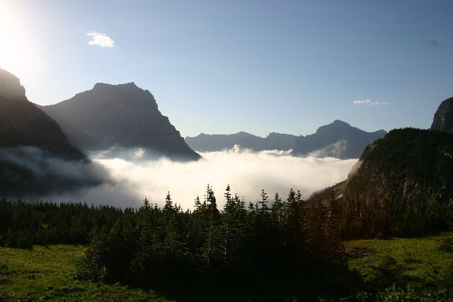
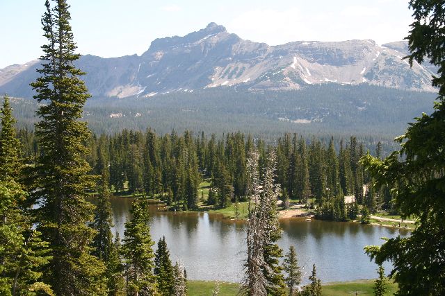
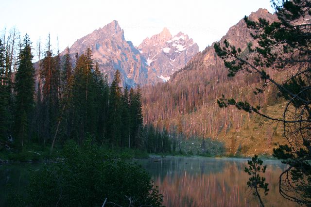
In the beginning...there was String Lake. What a beautiful morning to begin our hike!


Here's the bear showing off her clawing skills. Yes, I took the pic despite the fact that I was wondering if it might be the very last one I would take!


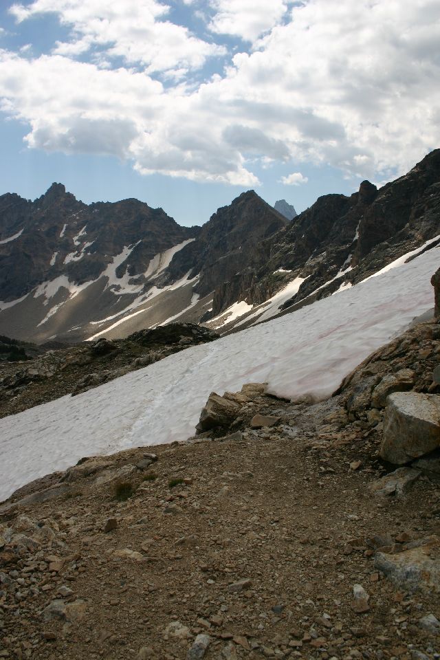
This is the snowfield that tried to claim my life. It doesn't look that bad in the pic but that's because you can't see the exposed sloped side and where it lead to if you should fall.


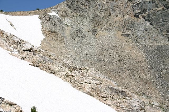
If you click on the photo to enlarge it, you can see the faint line going across and that is the trail. You can also see the tiny hiker making his away across it. It was right above this area that attempt number three to end my life ocurred. That's three stikes and you're out Grim Reaper! I'm a survivor, sucka!


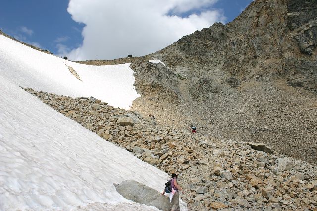
This was only the beginning of the scary section of loose scree. It was fairly stable in this section.


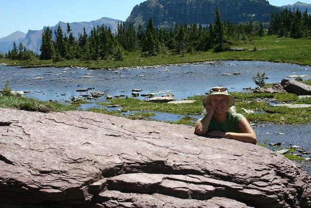
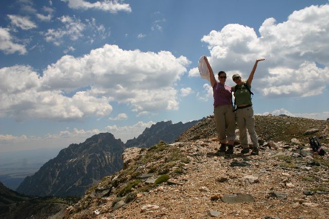
YAY!!! We made it! Best Friend and Outdoorsy Girl celebrate on top of the 10,700 ft. Paintbrush Divide!


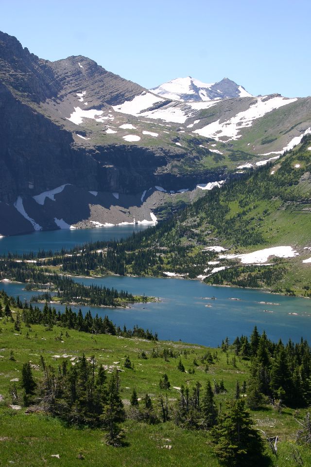
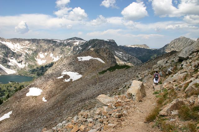
The descent was long and steep down the switchbacks to Lake Solitude.


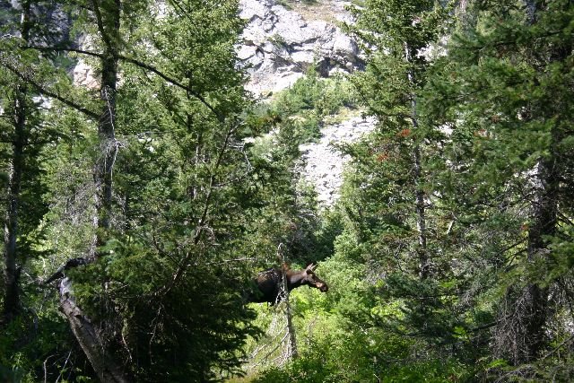
Moose in Cascade Canyon.


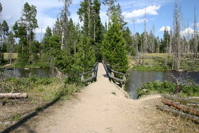
The end of the trail!!! After 20 miles and 11 hours and 45 minutes later, we were finally back at String Lake.

Thursday, July 27, 2006

The Wild Montana Sky and Hot Canadian Guy

Now joining my favorite National Parks list along with Yosemite and Grand Teton is Glacier National Park, Montana. The Going to the Sun Road that rises high in the park along the mountainous ridges and then above the clouds was incredible. The views were of deep, blue glacial lakes, snow fields, sharp and rugged mountains, and of course the park’s namesake, quickly retreating glaciers. The road provides the opportunity to travel through different climate zones as you begin in the green valley driving along trees and rushing blue waters and rise up into rugged, rocky mountains dotted with melting glaciers and snow.

I heard that Glacier has the densest bear population in all the country, minus Alaska. I didn’t see a bear or even a moose there, but I had my first look at the unique shaggy animal known as the mountain goat! I even had the opportunity to share the trail with one. This was an exciting thing for me, as one of my top hiking goals is to see and photograph the wildlife.

Best Friend and I had such a great time that day. And what a long day it was! I could not believe that 11:00 p.m. there is still light in the sky! The nickname “Big Sky Country” didn’t come from nowhere! Unless you were under the thick canopy of forest, the big sky could trick you into thinking it is two hours earlier than you think. Maybe this is what John Denver meant when he sang about the “Wild Montana Skies”.
My words could flow as long as the rivers the glaciers are melting to form and I would still not find it enough to describe the beauty and uniqueness of this place. Hopefully my photos will do it better justice.

After exploring the Montana side of the park for a day, Best Friend and I headed for the Canadian border to explore the other side of the park’s boundary in Alberta. After crossing the border into Canada, the park is known as Waterton Lakes National Park. While waiting our turn in customs, I noticed that there is an actual cleared, cut line separating the US from Canada with a marker labeled International Boundary. Why I found this amusing and downright funny, I have no idea. Maybe it was because when I looked at maps as a kid I wondered if there would actually be a line when I crossed into another country. I was disappointed when I took my first trip to Ontario, Canada and only got the Niagara River. Now, I chuckled to myself at this visible line separating one country from another. All laughing quickly subsided when we pulled up to the customs stop and my eyes fell on the most beautiful, perfect, hotter-than-Orlando Bloom man I have ever seen. He was so gorgeous and I had to agree with Best Friend as she muttered, “I like Canada already.” The national anthem should be changed from "O Canada" to "Ohhhhh Canada" in his honor. I think I want to marry a Canadian now.

When we finally arrived into the park and started noticing the things around us (rather than talking about how hot and perfect the Canadian Customs guy was), I found it a very beautiful place, though not quite what I expected. What I mean by that is Waterton Lakes is actually a town. In the US, a National Park is a wildlife and wilderness sanctuary. Of course, we do have our little stores and such in the parks, but people do not live in a US National Park (except in rare cases where a family had owned the land prior to the establishment of park status.) There were even signs in the town/park warning you to not approach any deer because they were dangerous and could attack your dog. I giggled again, because even though I know this is what happens to wild animals exposed to people, it was still preposterous to imagine a deer madly attacking as you and your pooch on a leash casually walk down the sidewalk. I did see many deer walking around the streets but luckily no dog attacks occurred. The park was still laid out very well and we checked out the sites...Cameron Falls, the Prince of Wales Hotel, and Red Rock Canyon. Red Rock Canyon was my favorite scenic area. The crystal clear water flowing through the glowing red canyon looked more like it belonged in southern Utah than in Alberta. It was unique and so pretty.

While visiting the park, Best Friend and I took the boat ride along Waterton Lake that begins in the Waterton village and crosses over the international boundary into the Glacier/Montana side of the park. This part of the Montana park, Goat Haunt, is not accessible by any roads. The ride across the beautiful lake was nice and relaxing, not to mention incredibly pretty. We scanned the shoreline for animals, but didn’t see much other than birds.

As our car fell into line for US Customs as we left Alberta for Montana, both Best Friend and I craned our necks hoping for another glimpse (and photo opportunity) of the incredibly perfect, gorgeous Canadian Customs Guy, but with no luck. My broken heart lifted a bit as we were greeted by two cute US Customs men (though nowhere on the same page as Canadian Customs Guy). I loved my day trip into Canada and found it very friendly but I felt a patriotic moment for my own beloved country as the cute American Customs guy smiled at me and said, “Welcome home ladies.” Though I do not live in the state of Montana, it is my home. This whole beautiful country is my home and I am proud to live in it. (Though I still think I want to marry a Canadian).


Early morning in Glacier.


Hidden Lake.


Enjoying some scenery along the trail to Hidden Lake.


Red Rock Canyon in Waterton Lakes National Park. This looks more like a southwestern scene than one in Canada.


You can see the international boundary line in this pic that I took out the car window.


The boat that took us across Waterton Lake to Goat Haunt, Montana.

Monday, July 24, 2006

Camping with a movie star

I have had a couple more great trips since my last post. One was a trip to the amazing Glacier National Park in Montana and an international crossing over into Alberta, Canada last week. This trip is so amazing that I want to take the time to pull my thoughts together to share. In the meantime, I will post about my latest trip taken over the past weekend. So please, the two or three of you who still read my blog, check in later for details on Montana and Canada!

While Best Friend was playing flight attendant on a four day trip, I went camping with Best Friend’s cousin and family in the mountains above Preston, Idaho. Preston is home of Napoleon Dynamite and the actual location of the movie. Since this movie is extremely popular and considered very funny by so many people, I will not talk about how stupid, pointless, and boring I personally found the movie to be. Preston, not having much more to offer, was very proud of the fact that the movie was filmed here. Posters, tee shirts, and other memorabilia could be seen all over town.

The campsite was pretty even though the bugs were horrendous. I took a walk looking for wildlife and rode an ATV. But mostly I just hung out around the campfire with everyone and shot the breeze. Best Friend’s Cousin’s Brother-in-law from Preston was along on the trip and had brought a couple of his horses along. One of these horses was in the wedding scene at the end of the above-mentioned (horrible) movie. So yeah, I camped out with movie star. Sweet.

On Saturday, we needed some ice so we drove into the historic town of Montpelier. The Oregon/California Trail ran right through Montpelier and several historic buildings still stood along the main street. The town was celebrating Butch Cassidy Days while we were there. One of the banks that Cassidy had robbed was right there in Montpelier. (One of the historic buildings still standing there, even though it is now a print shop.) Loving history the way I do, that was something I could really dig. There was a re-enactment of the robbery and a shootout that evening. It was pretty cool to watch. It definitely was worth the escape from the bugs!

After the “robbery” we were back in the mountains to join the insects and our famous camper who was doused with better insect repellant than I had. What can I say, she is pampered! Then again, aren’t all movie stars?


Here's the movie star! She doesn't sign autographs, though.


The actual building that housed the Bank of Montpelier stands behind the stage coach. Butch Cassidy and Elza Lay robbed this bank (and got away)on August 13, 1896.

Wednesday, July 12, 2006

Where in the world is Outdoorsy Girl?

Long time, no post! I can’t believe that I haven’t been able to post for so long! One of the things I am most looking forward to when I return to Georgia is a reliable computer–actually, reliable internet. I had looked forward to writing about and sharing all my experiences here in Utah and beyond but it has been a very difficult task. It seems my internet connection and free time can’t seem to come together. But here I am. For those of you wondering, I’m still alive and having a blast.

Picture Perfect Drive
I kicked off the month of July with a scenic ride with Best Friend’s family through the Uintas on the Mirror Lake Highway on July 1st. The highway winds through the beautiful Uinta Mountains in Northeast Utah. We began the route in Evanston, Wyoming winding back into Utah and ending in the town of Kamas. I had taken this route before but this day provided fairer (perfect, really) weather and even better opportunities to take lots of photos. Along this road are numerous lakes reflecting the high peaks surrounding them, the Provo River Falls, and countless other scenes that belong on a wall calendar. I even saw a moose along the road to Lake Whitney.

After this drive, I wished I had a Utah fishing license.

Camping in Dinosaur Land
The following day, Best Friend, Slot Canyon Boy, and I headed out to Vernal, Utah to meet up with Best Friend’s cousin and her family for a camping trip. We drove through the Flaming Gorge, which deserves a much nicer name. It was very color-rich (isn’t that better than flaming?) with reds, oranges, and other fiery tones. It’s a very beautiful area, but the most exciting thing for me to behold were the little road-side signs informing me that fossilized crocodile teeth, squid, and other oddities were found in the long-gone ancient sea floor that I was now riding along. There were fossils, fossils, fossils! I knew we were nearing the town of Vernal, which is known as Dinosaur Land. I cannot dig up ancient dinosaur bones in the moist soil where I live. Dinosaurs are a somewhat abstract and amazing thought to me.

We finally were greeted by giant dinosaur statues along the street signaling that we were now in Vernal. First we visited the Dinosaur Museum Park to take a look at some ancient fossils and learn more about the area. Next we headed off to Dinosaur National Monument to the dinosaur bone quarry. That was so awesome to me! This quarry is a huge pit dug in the middle of a dinosaur graveyard. You could see the vertebrae, leg, arm, and tail bones and skulls of dinosaurs right in the wall! I even got to touch some bones and feel very small standing next to a Diplodocus’s femur!

After acting like a kid, we followed Best Friend’s cousin and family from hot, dry Vernal to our camp site back in the mountains above Vernal in heart of Ashley National Forest. We camped in a very pretty area full of Aspen trees and lush meadows full of wildflowers. It was a perfect place to hike around the woods and across meadows. It was fun being an explorer in unmarked territory.

But the first night of camping was even more fun. And it became more and more fun as drinks were poured. The drinks resulted in a midnight ATV drive. My driver was a little scary, but more fun than scary. The campfire was nice and cozy when we returned from the ride and I stayed up longer than I should have talking with some of the guys. It’s amazing how speaking in a different accent and living in a place where none of them have ever visited could warrant so many questions. Does this mean that I am an interesting person?

It was a very fun night. You know fun has been had when nine year old twin girls yell out of their camper, “Dad! You have to come fold out our bed. Mom passed out!”

After a more relaxing night of camping the following night, we were early to rise and head out of the forest. We returned to Dinosaur Monument to drive the scenic route through the park along the Green River. We hiked and saw many cool petroglyphs and pictographs left behind by an ancient civilization. It was very amazing to walk along so many layers of rich history.

In Search of the Donners
On July 10th Best Friend and I headed out to Wendover. Part of Wendover is in Utah and part is in Nevada, which means casinos! We didn’t make the drive across the Salt Flats for gambling, though but for a trip into history. First, we wanted to stand in the place (one of the only places you can see this) to see the curvature of the earth. I did see a slight curve though it wasn’t exactly what I had imagined. I, for some reason, envisioned this to be a horizontal curvature, but it was not. Staring from this hill straight ahead at Interstate 80, I could see a slight curving, though if uninformed about what I was seeing (if I noticed at all), I would have thought it was a gentle hill I was looking at. Since I was informed, I knew that the interstate traveling through the salt flats was perfectly level.

After being like Christopher Columbus and proving that this earth is indeed round and not flat, we took on the role of investigating another piece of history...pioneer history. Like the dinosaurs, the pioneers and cowboys of the wild, wild West are somewhat of a mythical history to me as, until I met Best Friend and explored her native West, I had no tangible evidence of the reality of such things that I studied in my history books in school. I was thrilled and amazed a year and a half ago as I stood on the real Oregon Trail and gazed down at the still visible wagon wheel ruts of the trail. Naturally, when I heard that you could still see the tracks of the most famous pioneers, the Donner-Reed Party, near the Bonneville Salt Flats around Wendover, I was ready to find them.

With a hard-to-follow, vague map in hand, we headed for the scenic byway that would lead us toward Pilot Peak and the salt flats that these wagon trains had passed through. After we reached the right spot, a three mile hike was to lead us into the flats to the tracks. This byway was a dirt road and as I mentioned, the map was vague. The road and its forks were unlabeled. We took the wrong fork and wound up in the middle of the salt flats. It was so slick and muddy and we were sideways and anyway other than the way we were supposed to be. Worse than driving on ice! We turned around and finally found the path that we were supposed to have taken. It was an over 50 miles roundtrip on this dirt road. We had driven 7 miles and it felt like 20! The scenery was dull and dry and we were already thirsty. Discouraged by the deep ruts in the road, scorching heat, boring scenery, and urgently growing thirst, we decided that unless we wanted to re-enact the ill-fated Donners’ tragedies, then we better turn around. I really wanted to see their wagon ruts. I really wanted to see the spring they miraculously discovered in this parched desert. I wanted to stand in the footsteps of the Donners and see what they saw before they left the harsh Great Salt Lake Desert and headed into California’s mountains and met even harsher conditions that lead some of them to cannibalism. But my dry mouth and merciless thirst helped me sympathize enough with the Donners to give it up and turn around.

We went back into Wendover, not to gamble but to stuff ourselves silly at the grand buffet at Peppermill Casino. If my wishes of discovery couldn’t be fulfilled, at least my stomach was!

On our ride home we stopped at a rest stop along I-80 and gazed out into the wide open in search of wild mustangs that live in the area. I didn’t see a horse, but I did see a faint line crossing the interstate and disappearing into the distance. It was the famed California Trail, which shared part of its path with the Oregon Trail before breaking away in Wyoming and heading south into Utah and westward to California. I imagined what this trail must have looked like in 1849 when thousands flocked to California in search of gold.

I may not have found the Donners, but I still felt the old Western cliche come to reality as we rode off into one of the most beautiful sunsets I’ve ever seen. The only thing missing was the horse.


Just a sample shot of the scenery along the Mirror Lake Hwy.


Flaming Gorge. (I'm still racking my brain for a new name to rename it.)


Welcome to Vernal! Wish I could've taken a shot of the cowboy dino that greeted us.


Bones in the fossil quarry.


Ancient art along the rock walls.


The heart of Ashley National Forest near the spot we camped.


The white stuff in this picture isn't snow, but salt. I took this shot of the Bonneville Salt Flats along I-80 near the place where the world's fastest land speeds were recorded.


The above picture is the salt flat. This is your car on salt flats. Any questions? By the way, chunks of the salt flats are still falling from the underside of the vehicle!


Sunset over Great Salt Lake, one of the West's best.